
What is the Irish Peatland Map?
The Irish Peatland Map is an update to previous peatland maps in Ireland. It is the third iteration of an Adaptive Mapping Framework (AMF) developed by Connolly et al., (2007). The map uses a range of peat soil data to locate the distribution of peatlands in Ireland. It incorporates shallow peat soils instead of peat thickness threshold, which was traditionally used for commercial and agricultural activities. These shallow peat soils are extremely important for soil carbon storage. The research is part of the RePEat project, funded by the Department of Agriculture, Food and Marine (DAFM) and the EPA.
How was the map created?
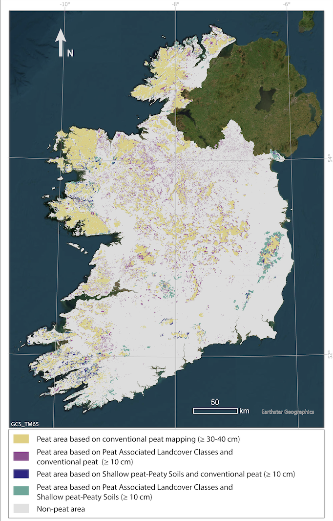
The map was produced with a processing resolution of 1 ha and the F1 score for peat areas was 83% (Gilet et al., 2024). By including datasets of peat soil containing 8.6% of organic matter or more that has accumulated to at least 10cm, the study developed a broader definition of peat soils. Furthermore, the peatland maps are updated continuously as new data on peat soils appears and an extra 20,000 points were included in the dataset to create a more reliable peat map than previous attempts. Peat soils were categorised based on topography and vegetation content, describing the type and land use change of the area. This allowed these areas that had been previously ‘hidden’ in other maps to be included.
 What are the outcomes of this research?
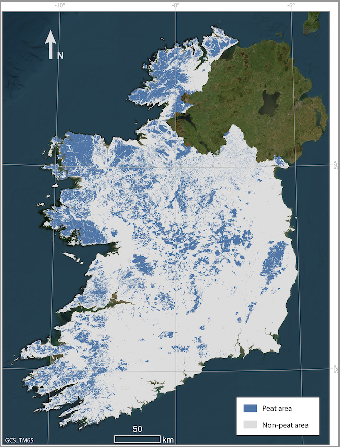
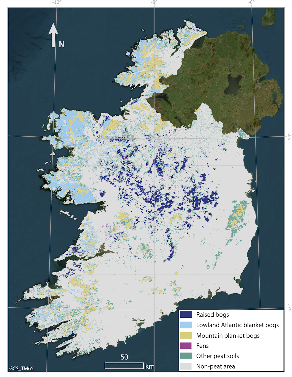
The project indicates that peat soils cover 1.66 M ha (23% of Ireland), which is 13% more area than identified in previous maps (Connolly and Holden, 2009). This is mainly due to the inclusion of a broader and less restrictive definition of peat soils in the dataset. Additionally, large areas of land cover were also re-classified as peat soils, which had previously been missed in other datasets due to land use changes. Lastly, the map is significant as it shifts our view of traditional commercial use of peatlands to acknowledging the environmental importance of peat soils.
Why is this research important?
Peatlands are highly important in the fight against climate change. Actively growing peatlands accumulate organic mass, and thereby sequester carbon due to excess vegetation production over decay. Carbon is taken in by peatland plants through the process of photosynthesis from carbon dioxide, largely from the atmosphere. Mapping carbon-peat soils aids in the proper management and regulation of peatlands for the reduction of greenhouse gases and increasing knowledge on environmental issues.
Louis Gilet, Terry R. Morley, Raymond Flynn, John Connolly, An Adaptive mapping Framework for the Management of Peat Soils: A New Irish Peat Soils Map.
View the article here